

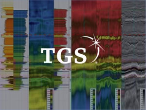
- FAULTS
- HORIZONS
- GEOBODIES
- STRATIGRAPHIC ZONES
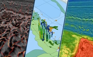
- DATA LABELING
- MODEL TRAINING
- MODEL QC
- ACTIVE LEARNING
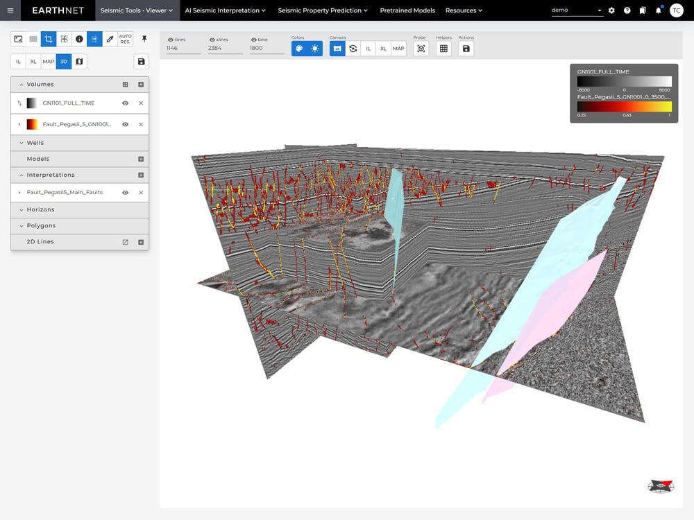
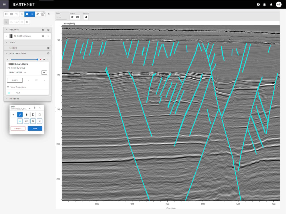
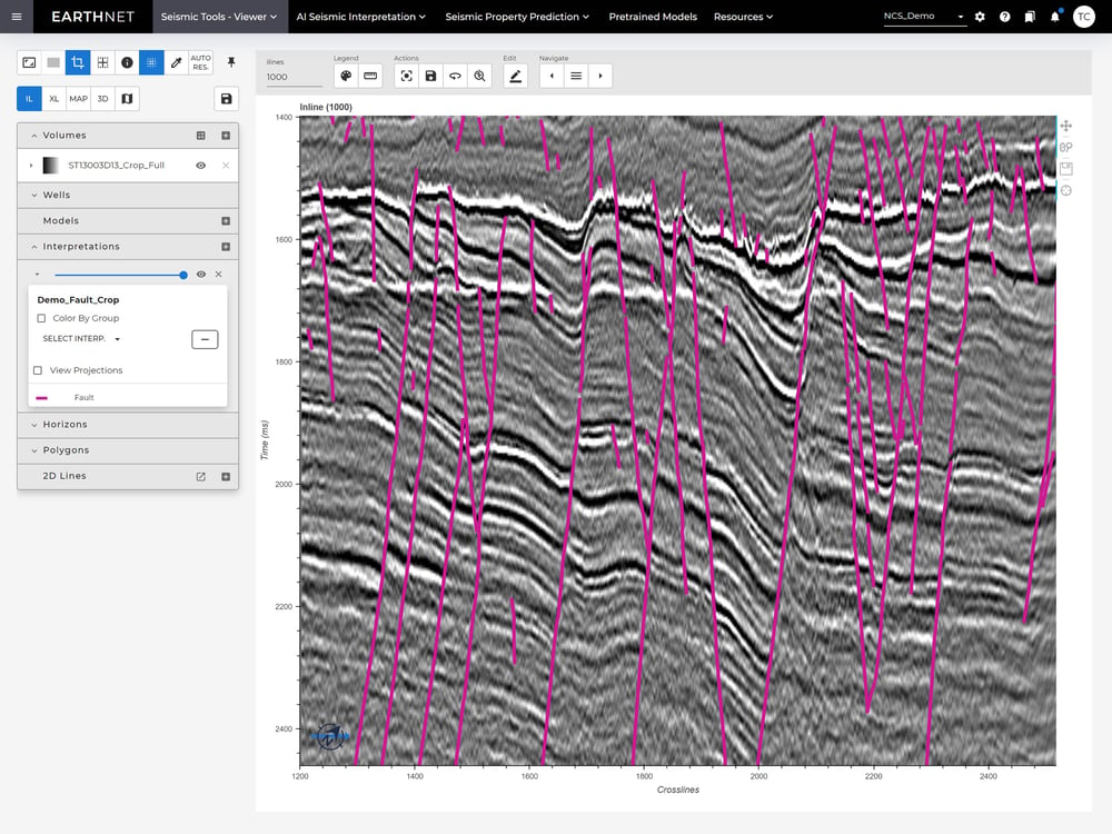
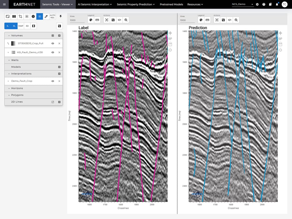
Fault interpretation
Interpretation of faults from seismic data can be accelerated with more than 10 x by leveraging pre-trained AI models. Since the AI models utilise all the data, it also improves the quality of the interpretation compared to traditional methods.
In EarthNET, you can do your fault interpretation using one-click pre-trained models, including 2DCNN models trained on expert interpretation and 3DCNN models trained on synthetic data. The 2DCNN models are interactive and you can iteratively improve their quality on your local dataset. The direct output from the AI model is a fault probability volume. From this volume, EarthNET can automatically extract fault sticks and surfaces.
Get Started with AI-Driven Fault Detection – Visit the AI Faults Page
Horizon interpretation
Leverage EarthNET's AI models to accelerate horizon interpretation from seismic data.
Our horizon interpretation feature is interactive, allowing you to iteratively improve the model's quality with your local dataset. The direct output from the AI model is a horizon probability volume. From this volume, EarthNET can automatically extract horizons and surfaces.
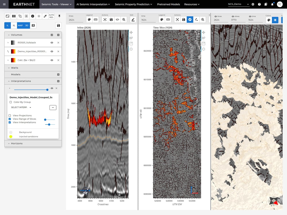
Interpretation of geobodies
Speed up the interpretation of geobodies from seismic data using EarthNET's AI models.
The geobodies interpretation is interactive, meaning you can iteratively improve the model quality on your local dataset. The direct output from the AI model is a geobody probability volume. From this volume, EarthNET can automatically extract a 3D mesh describing the location of the geobodies.
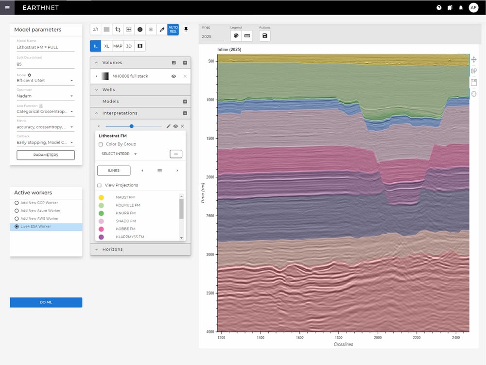
Interpretation of stratigraphic zones
Accelerate interpretation of stratigraphic zones from seismic data by leveraging EarthNET's AI models.
The stratigraphic zone interpretation is interactive, meaning you can iteratively improve the model quality on your local dataset. The direct output from the AI model is a stratigraphic zone volume. From this volume, EarthNET can automatically extract horizons and surfaces.
Data labeling
EarthNET AI Seismic interpretation models learn from labels representing the ground truth. The more accurate labels you train your model on, the better the model will perform.
EarthNET provides customised labeling tools for horizons, faults, geobodies and stratigraphic zones. You can also import labels from available sources such as seismic interpretation done in other software packages.
Model training
In EarthNET AI Seismic interpretation, you can train ML models from scratch to predict your objects of interest, including horizons, faults, geobodies and stratigraphic zones.
You get access to a large number of deep learning model architectures in EarthNET including neural networks such as Unet’s and transformers. We follow the state of the art and make sure we provide the latest and best ML architectures.
Model QC
Review and compare model results and performance metrics for multiple models to identify the models that perform best for your tasks.
All your trained ML models will be stored in your model library, along with all the metadata that describes the training data used, the model architecture, parameters, and results. With full information about each model, you can quickly identify potential causes for suboptimal performance, mitigate them and re-train the model.
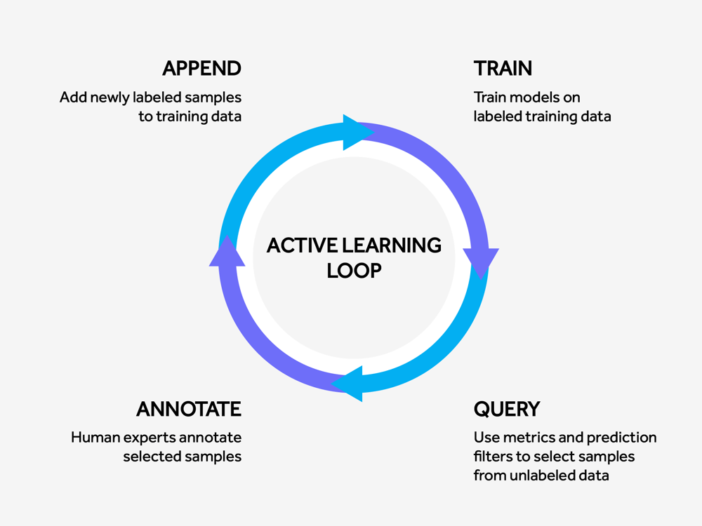
Active learning
The infrastructure in EarthNET facilitates active learning to ensure that you have a set of models that improve over time with minimal effort.
EarthNET supports active learning workflows through quantifying model performance, improving input data through data cleaning and labeling, retraining models using the improved input data, and tracking model performance over time.


Get in touch
We are dedicated to helping our clients unleash the full potential of their data.
Let's talk about the opportunities, and explore how we can assist you.