USE CASE
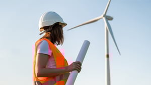
Offshore Wind Placement
Determining exact areas and locations for installing power-producing wind turbines at sea
Offshore wind placement is the process of determining exact areas and locations for installing power-producing wind turbines at sea. This is a crucial aspect of the transition to renewable, green energies, as it minimises CO2 emissions and helps mitigate global warming.
Why you need AI-driven geoscience software
When you are determining the layout of your offshore wind farm, you need to map the geotechnical properties of the seabed and substrate efficiently. Increase speed more than 10X by leveraging AI instead of traditional methods for boulder detection.
Healthy project economics for wind farms requires that we find ways to keep costs down. AI software can assist geoscientists to reduce costs for geotechnical studies.
By using AI models trained on vast amounts of QC'ed data, you reduce the human bias and subjectivity associated with traditional methods, thus increasing the accuracy of the interpretation.

Time-consuming manual analysis
The challenges facing offshore wind placement include deep waters, which limit the use of certain windmill types, the need for consistent and solid foundations for anchors, and uncertainty around the seabed composition.
This uncertainty can lead to inefficiencies and reduced profitability for an in-demand technology, particularly as current geological interpretation methods are inefficient and do not scale well for large offshore wind projects
Traditional methods involve manual analysis of survey data. This process is time-consuming, taking several days to weeks per individual seismic survey, and analysis is prone to human bias and interpretation error.
Offshore wind placement
using EarthNET
When developing wind farms offshore it is important to have the best possible information about the seabed substrate conditions, to ensure that anchoring methods can be selected and turbines placed appropriately. This information is obtained by collecting seismic data and Cone Penetration Tests (CPT), which needs to be interpreted. Traditionally, this is process is labour-intensive, time-consuming, and expensive. With EarthNET, you can use AI models to automate seismic interpretation for boulder detection and to map geotechnical properties in 3D.

Detect boulders from
seismic data using AI
Ultra High Resolution (UHR) seismic data is capable of imaging boulders in the shallow subsurface. With the AI models in EarthNET, you can interpret the spatial distribution and size of the boulders.
Explore the features of EarthNET AI Seismic Interpretation →
Map geotechnical properties in 3D from seismic data using AI
With EarthNET, you can train AI models on seismic combined with CPT data and use the trained models to predict geotechnical properties in 3D. The 3D property volumes can be used in ground models for planning of wind farm development.
Explore the features of EarthNET AI Seismic Properties →

"These AI methods enable a greater degree of data integration in the ground modelling workflow, improving the quality of the ground model compared to using traditional geostatistical methods."
Learn more about our products and services
EarthNET
Our groundbreaking suite of geoscience tools leveraging cloud-technology, high performance computing, and artificial intelligence to liberate your subsurface data and innovate your workflows.
Explore →
Consulting Services
Our expert team is here to guide you every step of the way, whether you're just starting out with AI and machine learning or looking to integrate EarthNET into your existing operations.
Explore →
Multi-Client Products
With our data packages, you get access to cleaned, indexed, contextualised, and interpreted data that can be plugged directly into your geoscience workflows, saving you time and resources.
Explore →
Get in touch
We are dedicated to helping our clients unleash the full potential of their data.
Let's talk about the opportunities, and explore how we can assist you.

