

- OBJECT DETECTION
- IMAGE CLASSIFICATION
- IMAGE SEGMENTATION
- MODEL-ASSISTED LABELING
- PRE-TRAINED MODELS
- UNCERTAINTY MEASURES
Object detection
Use the object detection functionality in EarthNET AI Images to identify the class and location of objects within images. This method is well-known from applications such as facial recognition and identifying objects in street images.
In geoscience, this computer vision method can be used to classify, locate, and count different types of rock. You can simply outline classified objects with rectangular bounding boxes. This can also be expanded to instance segmentation, where objects are precisely outlined with segmentation masks.
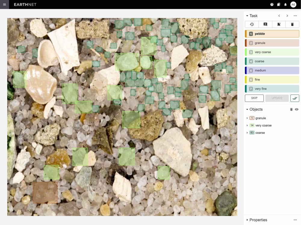
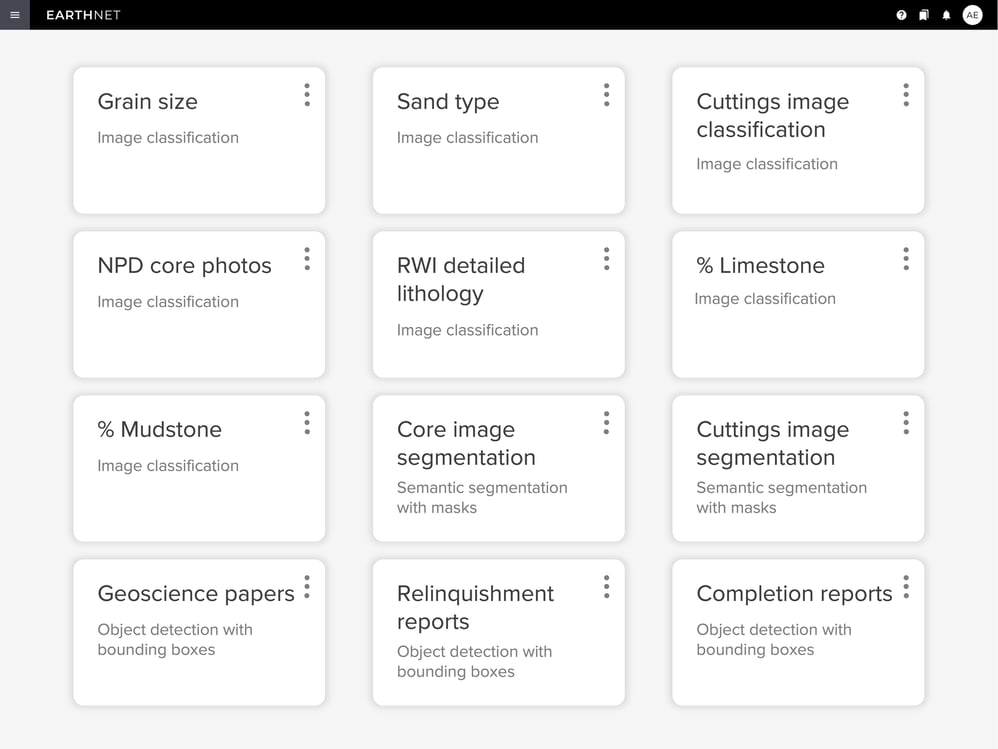
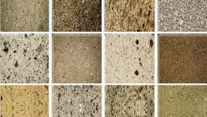
Image classification
Use the image classification functionality in EarthNET AI Images to assign a class to each image. During image classification of rock samples, the labelling and deep-learning prediction steps can be supported by the combination of image data with a rich suite of metadata including, stratigraphic information, elemental composition (XRF), mineralogical composition (XRD) and more.
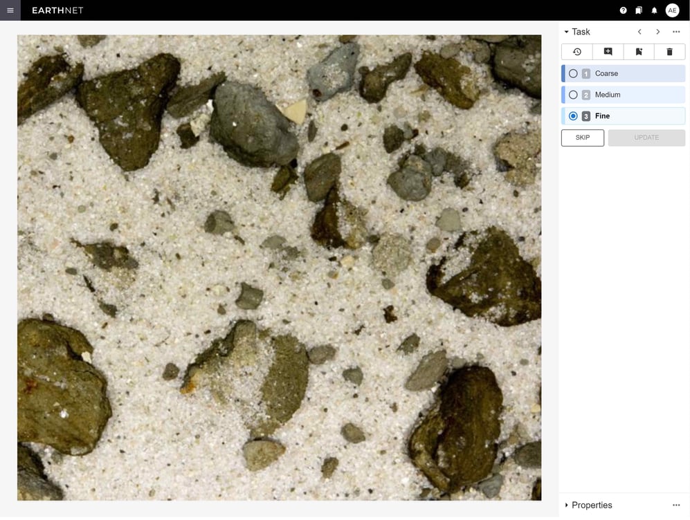
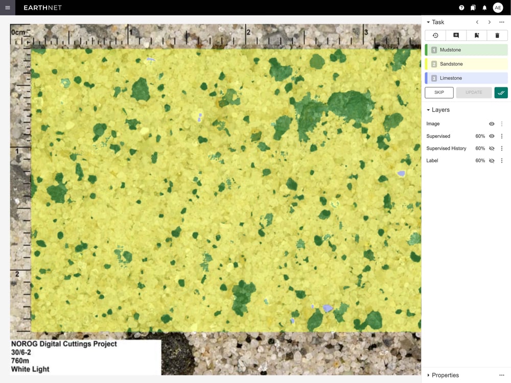
Image segmentation
Use the image classification functionality in EarthNET AI Images to to extract very detailed information from images. Our detailed workflow for image segmentation includes rapid annotation, unsupervised segmentation, semantic embedding, and training of supervised segmentation models.
Compute percentages of minerals and lithologies from the segmentation mask and transfer the data to the well-log domain, enabling integration of image data with the well-log and seismic data.
Model-assisted labeling
Labeling data can be a time-consuming and expensive task in geoscience work. EarthNET AI Images provides model-assisted labeling functionality that speeds up the labeling process by using pre-trained machine learning models. Our models perform the initial labeling, and human experts review the results and make adjustments if needed.
Another means to speed up data annotation in EarthNET is through programmatic labeling, where you assign appropriate classes using rules based on existing labels, model predictions, and metadata.
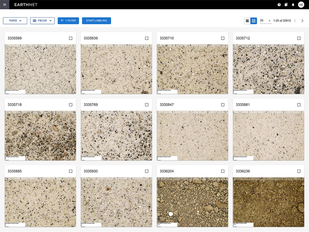
Pre-trained models
EarthNET AI Images provides you with pre-trained models for cuttings and core images. These models provide a reliable and efficient interpretation of image data with just one click. You can also build upon the pre-trained models to improve their capabilities, instead of building a model from scratch. Our pre-trained models include lithology classification, lithology segmentation, grain size classification, and sand type classification.
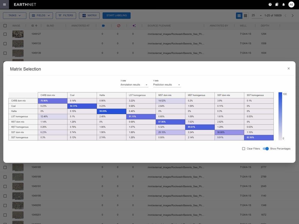
Uncertainty measures
The multiple interpretation modes in EarthNET AI Images enable you to quantify the uncertainty in their data. We provide a confusion matrix that allows for comparison of input and output from a model, or comparison of outputs from two models. Easily filter by input/output disagreement to identify errors and problems that need to be corrected through additional labeling.


Get in touch
We are dedicated to helping our clients unleash the full potential of their data.
Let's talk about the opportunities, and explore how we can assist you.